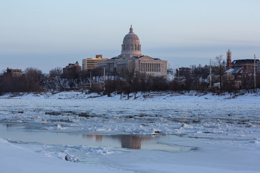
Despite the arrival of spring, a lingering chill continues to grip North America. The unexpected change in weather patterns results from a sudden disruption in the polar vortex, an atmospheric phenomenon that has pushed frigid air southward. As a result, large portions of the eastern United States and Canada are experiencing below-average temperatures, with some areas even facing the possibility of snowfall.
A Sudden Shift in Atmospheric Patterns
The polar vortex is a vast low-pressure system of cold air that typically circulates around the Arctic. This powerful system is closely linked to the polar jet stream, a strong wind current that helps contain cold air near the poles. However, disturbances in the vortex can weaken this barrier, allowing frigid air to spill into lower latitudes.
A major atmospheric pressure shift occurred when the polar vortex collapsed. This breakdown was triggered by a rapid warming in the stratosphere, setting off a chain reaction that reshaped weather patterns across the Northern Hemisphere. The impact of this event has been particularly noticeable in the eastern half of North America, where cold Arctic air has surged southward.
While disruptions in the polar vortex are not uncommon, this particular event has had a strong influence on seasonal weather. Instead of the expected springtime warmth, many regions are now experiencing conditions more typical of winter.
Cold Grips the East, Warmth Builds in the West
As a result of this atmospheric shift, temperatures across the Midwest and Northeast are significantly lower than usual. Cold air has settled over these areas, bringing unseasonable chills and the potential for snow in some northern regions of the United States and southeastern Canada. Even where snowfall remains limited, freezing temperatures have created an unusual contrast with the expected spring climate.
In stark contrast, the western United States and the Great Plains see above-average temperatures. High-pressure systems in these regions prevent the cold air from advancing westward, leading to unseasonably warm conditions in some states. This sharp divide between the East and the West highlights the dramatic influence of the polar vortex’s instability.
How Long Will This Last?
With cold air firmly in place across eastern North America, many wonder how long these conditions will persist. Current atmospheric patterns suggest that chilly weather could continue for an extended period. The timing of a return to normal temperatures remains uncertain, as the effects of a disrupted polar vortex can be unpredictable.
Although the exact duration of this cold spell is unclear, signs of its impact are already visible. Ice storms, snowfall, and freezing temperatures have disrupted daily life in several areas, reinforcing the strength of this unusual weather pattern.
As the atmosphere stabilizes, temperatures will eventually return to their seasonal norms. However, this abrupt return to winter-like conditions is a stark reminder of the powerful forces shaping global weather. For now, those in affected regions will have to endure the lingering effects of the polar vortex’s collapse, with a hopeful eye on the return of warmer days ahead.


